Here’s what you need to know:
Credit…Dave Sanders for The New York Times
Tropical Storm Henri, downgraded from a hurricane but still packing 60-mile-an-hour winds, made landfall near Westerly, R.I., early Sunday afternoon, having already cut power to more than 115,000 homes from New Jersey to Maine.
The storm, with sustained winds of 57 miles an hour recorded at nearby Port Judith, is expected to bring extensive coastal flooding and continued heavy rain, even as it quickly weakens over land, the National Hurricane Center said.
About three-quarters of the homes in coastal Washington County on Rhode Island, which is home to more than 125,000 people and includes Westerly, were already without power at 12:15 p.m. Eastern time, when the storm hit land.
Rainfall ahead of the storm’s landing — a record 4.45 inches fell in Central Park in New York City on Saturday — crippled railroad service on Long Island and in southern New England and forced the cancellation of hundreds of flights on Sunday at the airports serving New York City. Widespread roadway flooding was reported in New York and New Jersey.
Storm surges of two to four feet were possible on Sunday along the Atlantic Ocean and Long Island Sound coasts, from Queens in New York City to the tip of Long Island, and in New England from Connecticut to the base of Cape Cod, the hurricane center said.
That was down from the three-to-five-foot surges that had been forecast earlier, but still enough to swamp coastal communities with wind-driven seawater with the potential to cause serious damage and threaten lives. Rainfall totals of up to six inches were forecast for much of the Northeast, with isolated pockets of up to 12 inches.
National Guard troops stood ready to clear debris and make high-water rescues in New York, Connecticut and Massachusetts. The hurricane center discontinued its tropical storm warning for coastal New Jersey and parts of New York.
With eight inches of rain possible in Connecticut, the coastal towns of New Haven, Branford, Guilford and Groton recommended that residents on streets closest to the water evacuate. New York officials warned of possible dangerous storm surges in parts of the Bronx and northern Queens.
In preparation for the storm, New York suspended outdoor dining and closed beaches for swimming for Sunday. The Metro-North Railroad suspended all service on its New Haven line and partly suspended some other service. Long Island Rail Road canceled some Sunday morning trains also.
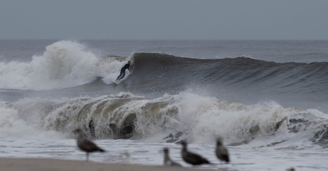
Just before 9 a.m. Sunday in Montauk on Long Island’s eastern tip, waves battered a pier and stores downtown were closed save for Anthony’s Pancake House and a 7-Eleven with its windows boarded up and “open” spray-painted in neon orange.
At Ditch Plains Beach, Joe Scollan, 59, a plumbing contractor, was taking pictures outside the vacation home he has owned for more than 30 years. High tide was expected within the hour. “The next couple of hours will tell the tale, but we lucked out,” he said. “We dodged a bullet.”
 Credit…Brian Snyder/Reuters
Tropical Storm Henri cut the power to much of coastal Rhode Island as it made landfall on Sunday, downing utility lines and severing service to more than 70,000 homes, according to the utility National Grid.
In Washington County, home to more than 125,000 people, three-quarters of homes already lacked power as of 12:15 p.m. Eastern time when the storm landed at the town of Westerly.
State authorities had closed three bridges — the Newport Pell Bridge, the Jamestown Verrazzano Bridge and the Mount Hope Bridge — because of high winds. At 11 a.m., the state banned motorcycles and tractor-trailers from roadways until further notice.
“I’m asking you, Rhode Island, to stay home until this storm passes,” Gov. Dan McKee said in a morning news conference. “If you venture out, you are not only putting your own life at risk, you are endangering our first responders.”
Providence’s hurricane barrier was closed Sunday morning, as were vehicle gates designed to keep traffic from roads near the Providence River. It is the first time the vehicle gates have been closed for a storm since Sandy in 2012, according to Clara Decerbo, director of the Providence Emergency Management Agency.
Winds from the tropical storm could near 70 miles an hour — close to the 74-mile-an-hour threshold for a Category 1 hurricane. “Most people that die during storms like these are going to watch the waves at Narragansett, or something like that, and get swept out to sea,” Ms. Decerbo said.
The areas near Providence’s waterfront were quiet Sunday morning except for some joggers, sightseers, and a few people fishing.
James Ales and Meghan Sharp came out to see the hurricane barrier, whose gates had shut for the first time since they’d moved to Providence two years ago. They had already prepared for the storm, buying batteries and groceries, and shifting things around in their basement, which floods even in slight rain.
A man fishing on the Providence River, who offered only his first name, Mike, said he planned to stay there “until my wife calls me and says, ‘Get home.’”
 Credit…Mary Altaffer/Associated Press
In one of his final acts as governor, Andrew M. Cuomo said at a news conference on Sunday that he had declared a state of emergency in New York as Tropical Storm Henri approached the eastern tip of Long Island and threatened to bring heavy rainfall across the state.
Mr. Cuomo is expected to resign on Monday night, after an investigation by the state attorney general found that he had sexually harassed 11 women.
But even as the state deployed National Guard troops, generators and excavators in preparation for the storm, his replacement, Lt. Gov. Kathy Hochul, who is set to be sworn in on Tuesday morning, was noticeably absent from Sunday’s news conference.
Ms. Hochul has been briefed by the governor’s office on the progress of the storm, an administration official said, but her team had to request the information.
Mr. Cuomo’s office declined to comment on the nature of the storm briefings.
Asked why Ms. Hochul was not present at the news conference, Mr. Cuomo said that she had been briefed and that he was in “constant communication” with her. He said that effects of the storm were expected to be over by Monday evening and that state officials “don’t expect any real significant damage post the event.”
“Nothing on the scale of Superstorm Sandy, for example,” he said.
Mr. Cuomo said he had asked emergency management officials who were thinking of stepping down when he resigns to stay on until the storm’s effects pass.
My team and I are continuing to closely monitor #Henri.
The storm has weakened slightly, but that does not mean the risk is gone.
Storm surge, heavy rain and flooding (including inland flooding) remain serious threats.
New Yorkers, please monitor updates & stay safe.
— Kathy Hochul (@ltgovhochulny) August 22, 2021
The emergency declaration meant that the state could use federal funds to prepare for Henri. Mr. Cuomo said that rainfall leading into Sunday had already saturated the ground, and that forecasts showed around four to five more inches of rain falling through Monday in the Catskills, Westchester County and Suffolk County.
Mr. Cuomo compared the forecasts to the devastation caused by Hurricane Irene and Tropical Storm Lee, which hit within days of each other in 2011.
“You have hills, you have creeks, the water comes running down those hills, hits what was a creek and turns it into a ravaging river,” he said. “I have seen towns float away.”
Mr. Cuomo said about 500 National Guard troops and 1,000 state police had been deployed around the state in preparation for Henri. Bulldozers were moving sand around the South Shore of Long Island to guard against storm surge, which could be up to five feet, Mr. Cuomo said.
Still, Mr. Cuomo also said that the storm had veered eastward compared to earlier projections of its path, meaning the hit on New York would not be as bad as initially expected.
Dana Rubinstein contributed reporting.
 Credit…Michelle Mcloughlin/Reuters
As Henri shifted further east on Sunday, the storm’s landfall trajectory moved to just over the Connecticut border toward Rhode Island.
Connecticut will not be spared, however. Heavy rain and flash flooding in the western and central parts of the state will add to the effects of strong winds, and likely will contribute to downed trees and power outages.
“We’re still expecting to see anywhere from 60 m.p.h. to 70 m.p.h. winds along the Connecticut coast,” said Bryce Williams, a National Weather Service meteorologist in Boston.
Four to six inches of rain will fall around the state on already-soaked ground, and some places could get even more rain, Mr. Williams said in a phone interview on Sunday morning.
Storm surge — when the ocean pushes water onto the coast, raising the water level — will likely reach three to five feet on Sunday afternoon, Mr. Williams said.
With Henri on track to make landfall by early afternoon, the storm surge will hit the Connecticut coast during low tide, reducing the rush of water onto properties and beaches. But a second surge is likely during high tide on Sunday evening, and that will probably increase the volume of water pushing onto the shore, Mr. Williams said.
Officials in several coastal communities issued evacuation orders for shoreline residents. Shelters opened for evacuees along the coast on Saturday and Sunday.
Eversource Energy, the state’s largest electricity provider, said on its website that about 700 customers were without power on Sunday morning.
Religious services were canceled in dozens of municipalities across the state, along with concerts and other events planned for the waning days of summer, WTNH reported.
Service was suspended on the Metro-North Railroad’s New Haven line, including the New Canaan, Danbury and Waterbury branches, the Metropolitan Transportation Authority said.
About half of the scheduled flights at Bradley International Airport north of Hartford had been canceled by Sunday morning, said Kevin Dillon, the executive director of the airport authority. “We are expecting more cancellations through the day; the airlines’ schedules are fluid,” he said.
Mr. Dillon said he hoped that some of the flights scheduled to arrive Sunday evening would be able to land and that flights could resume a normal schedule on Monday.
 Credit…Tony Luong for The New York Times
NEW BEDFORD, Mass. — Against gathering winds, the 400-ton steel doors connecting the city’s hurricane barrier groaned into place Sunday morning, sealing off the region’s largest fishing port as southern New England braced for the impending storm. The New Bedford Hurricane Barrier hadn’t closed because of a storm since Sandy in 2012.
Those able to make it inside were packed tight, wooden sailboats and lavish yachts jammed beside the rusted fishing vessels more typical of this industrial harbor, bobbing in the nervous swells. Those still at sea were expected to find another port.
“Once it’s closed, it’s closed,” said Justin Poulsen, director of the New Bedford Port Authority. “You can’t underestimate this kind of storm.”
The last vessel to enter the harbor, 22 minutes before the barrier closed, was the Eagle Eye II, a New Bedford swordfish vessel, according to M.L. Baron, who runs a weather website out of neighboring Fairhaven. Tropical Storm Henri was expected to hit New Bedford late Sunday morning or early afternoon.
The New Bedford Port Authority announced that it was at capacity by midday Saturday. Vessels hailing from New Jersey, Rhode Island, New York and Massachusetts were stacked six deep along the docks. Many had cut their trips short.
“You want to be protected when nature turns ugly,” said Walter Ramos, 59, who powered his 55-foot sloop, Beneteau, from the exposed port in Dartmouth to New Bedford.
John Alvernaz, 55, a deckhand on the William Lee, a roughly 75-foot scalloper out of New Bedford, said their crew was about 100 miles offshore Friday afternoon when they felt the winds pick up. They had caught about a quarter of their 18,000 pound quota when the captain made the call to steam back to port.
“A storm like this, we weren’t going to take a chance,” he said.
Nearby, a local shipyard was busy hauling out a double-decker yacht flagged from Newport, R.I. Further down the port, vacationers in bathing suits and carrying luggage streamed off the Seastreak ferry from Martha’s Vineyard, an island about 15 miles southeast.
Hotels in New Bedford were packed as tight as the docks. Weddings that had booked rooms through the weekend were canceled, and fishermen, yacht owners and power-company employees have taken their place.
“We’re New Englanders. This is what we do,” said a clerk at the New Bedford Harbor Hotel. “We buckle down and get through it.”.
Mr. Baron, who was on the sea wall on Sunday morning, recalled the sound of sirens, barely audible through the wind, as the gates closed for Hurricane Bob 30 years ago. At least three fishing boats were locked out, forced to weather the storm outside the barrier.
“They were angry,” he said. “But they rode it out — bow to the wind and full throttle.”
 Credit…Karsten Moran for The New York Times
In the dark hours as Henri churned in the Atlantic below Eastern Long Island and New England, New York City was deluged by historic rainfall.
In Central Park, 1.94 inches of rain fell between 10 p.m. and 11 p.m. Saturday, the most in a single hour at that location “since record keeping began” in the 19th century, according to the National Weather Service.
The 4.45 inches that fell in Central Park on Saturday was also an overall record for Aug. 21, the service said. Around the city and across northern New Jersey and southern Connecticut, three to six inches of rain fell overnight.
The storm crippled parts of the region’s mass transit system. As of 9 a.m. Sunday, the Metropolitan Transportation Authority had suspended train service on five of seven Metro-North Railroad lines and had partly suspended service on Long Island Rail Road’s Montauk and Ronkonkoma lines.
Portions of the New York City subway on the 1 and 3 lines were suspended because of flooding, though service has since resumed. The three airports serving New York City also experienced the effects of the storm, as more than 20 percent of flights were canceled at La Guardia and Newark airports on Sunday and more than 10 percent were canceled at Kennedy Airport, according to the Port Authority of New York and New Jersey, which operates them.
Social media was inundated with images of roadways turned to rivers with cars pushing through them, washed nearly to their headlights.
The National Weather Service reported overnight flash floods in Crown Heights, Bay Ridge, Battery Park, Harlem and on the Throggs Neck Bridge, as well as around Long Island and New Jersey.
Late Saturday night, a few hundred hardy attendees of the ill-fated Homecoming Concert in Central Park sheltered in a backstage tent hoping for an acoustic performance on a makeshift stage from rock stars who had yet to perform.
After hinting at the possibility around 10 p.m., a poncho-clad Mayor Bill de Blasio returned 20 minutes later and said, “we have to ask everybody to go home because the rain keeps coming.”
The fans who had come to hear songs from their favorite records exited into record rainfall.
 Credit…Chang W. Lee/The New York Times
As Henri made landfall in Rhode Island on Sunday, reports indicated about 115,000 customers were without power from New Jersey to Maine. Here’s how power companies are dealing with the storm:
-
The utility PSEG Long Island said more than 1,200 contractors and additional crews have been brought in to help prepare for the storm. But it warned customers that outages could last seven to 10 days — or up to two weeks if the forecast worsens.
-
Gov. Andrew M. Cuomo said that power companies in other regions of New York State that could be heavily affected by the storm, including National Grid and Con Edison, had also called in private contractors and additional personnel to help restore power. “I have told them clearly,” he said on Saturday, “this is what we pay the power companies to do, to be ready for storms.”
-
In New Jersey, the state’s largest utility, Public Service Electric & Gas, told customers to prepare for possible debris and fallen power lines but did not project an estimate for potential power losses.
-
National Grid, the main electricity provider in Rhode Island, reported more than 63,800 customers had lost power in the state as of noon on Sunday, with more than 54,000 in Washington County.
-
Gov. Charlie Baker of Massachusetts warned that Henri could cause at least 100,000 residents — and possibly up to 300,000 — to lose power.
-
The utility Eversource, which provides power to about 1.2 million customers in Connecticut, said that at least half of them could be without power for several days after the hurricane. More than 19,000 customers had lost power as of noon on Sunday.
 Credit…CJ Gunther/EPA, via Shutterstock
Henri was downgraded to a tropical storm on Sunday, but it was still expected to bring heavy rain, potential flooding and a dangerous storm surge.
Here’s how to prepare for a hurricane or tropical storm:
Before the storm
Ahead of a storm, the Federal Emergency Management Agency recommends signing up for local weather alerts and learning evacuation routes.
In the event of a power loss, the National Weather Service suggests having a battery-operated radio for news updates.
The Red Cross suggests preparing an emergency kit with the following items: water (enough for one gallon per person per day), nonperishable food, a flashlight, a first aid kit, a multipurpose tool, hand sanitizer or sanitation wipes, important personal documents, blankets and maps of the area.
FEMA also recommends preparing a “go bag” with essential items, such as medications, and securing important documents, such as financial, medical, school and legal records.
During the storm
During a storm, FEMA suggests staying away from windows in the event of high winds, and seeking shelter on the lowest level of a home in an interior room, such as a closet.
If there is flooding, FEMA says people should seek higher ground. In the event of flooding, the National Weather Service says those driving should never drive through flooded roadways. Two feet of flowing water is enough to float a vehicle.
Residents should heed guidance from local officials, and promptly follow any evacuation orders.
After the storm
Once a storm has passed, the authorities still urge drivers to avoid flooded roadways. Anyone who evacuated should wait to return until local officials say it is safe to do so.
Residents in an area affected by a storm should also avoid drinking tap water unless local officials say it is safe to use.
 Credit…Cristobal Herrera-Ulashkevich/EPA, via Shutterstock
Having an ample supply of clean water is a top priority during extreme weather systems such as Tropical Storm Henri.
But why?
“You don’t know what is necessarily going to happen due to the storm’s impact,” said Stefanie Arcangelo, an American Red Cross spokeswoman. “The storm could impact the public water system.”
Often during or immediately after a storm, a boil water advisory will be issued, meaning there could be contaminants in the water that could make it unsafe to drink, she said.
That’s why the American Red Cross and the Federal Emergency Management Agency recommend that people store a gallon of water per person per day just in case a storm damages the water system or knocks out electricity, which could prevent people from boiling water.
The average person drinks about half a gallon of water, but people will also need water for food preparation and hygiene, FEMA said.
“To prepare the safest and most reliable emergency supply of water, it is recommended that you purchase commercially bottled water,” FEMA said. “Keep bottled water in its original container, and do not open it until you need to use it.”
If people don’t want to buy water in plastic bottles, they can put regular tap water in clean, tightly sealed containers or bottles, FEMA said.
If water supplies run low, drink the amount needed that day and then try to find more the next day, the agency advises, adding that reducing activity and staying cool can minimize the amount of water the body needs.
 Credit…Kayana Szymczak for The New York Times
It is a new, foreboding normal in low-lying cities coming to grips with climate change: As Tropical Storm Henri approached the New England coast, crews of workers in Boston installed metal posts and aluminum planks around the entrance of the Aquarium subway station to keep floodwaters from cascading down from street level.
The city was jolted in 2018 when freezing runoff from a winter storm gushed down the station’s stairs and forced the Blue Line to close. Flood control has become a focus for Boston’s subway system, which weaves through tidal flats and marshlands and a mile-long underwater tunnel to connect outlying neighborhoods to downtown.
A study published this month in the journal Transportation Research called climate change an “existential threat” to public transit in Boston: Given the expected rate of rising sea waters, an extremely strong storm — one with a 1 percent chance of occurring in a given year — would completely inundate the Blue Line and much of the Red and Orange Line.
A storm of that magnitude in 2070, the researchers found, would flood nearly the whole network, with only 9 percent of passenger trips remaining unaffected.
“In the more severe scenarios, I was frankly surprised at how much of the system was affected,” said Michael Martello, a Massachusetts Institute of Technology researcher and lead author on the report, which was funded by the Massachusetts Bay Transportation Authority.
On Sunday morning, with the storm’s core projected to move into central Massachusetts, it appeared Boston would see high winds but be spared the heaviest rains, receiving one or two inches.
Flooding subways are a visible reminder of the vulnerability of cities to rising sea levels; in July, Tropical Storm Elsa sent floodwaters cascading down subways in northern Manhattan and the Bronx. The same month, a catastrophic flood inundated the subway in Zhengzhou, in central China, leading to the deaths of 12 people, and incredulous commuters in London shared photographs of flooding in the Tube.
Boston, a peninsula enlarged by vast stretches of man-made landfill in the 19th century, is particularly vulnerable to rising waters, activists say.
“Our built environment was built for rainfall patterns of the past, certainly not for what we are seeing now or for what is coming,” said Emily Norton, the executive director of the Charles River Watershed Association, who noted that many of the city’s prestigious medical centers sit atop former wetlands.
“If Sandy had hit Boston during high tide, we would have looked like Katrina,” Ms. Norton said. “Boston is very, very vulnerable, and we’re not acting like it.”
 Credit…Lukas Flippo/The Sun Herald, via Associated Press
Hurricanes and tropical storms are defined by their powerful winds. But the storm surges they produce can often prove just as destructive in coastal communities.
Tropical Storm Henri was expected to create dangerous storm surges in parts of Long Island, Connecticut, Massachusetts and Rhode Island.
Storm surge is defined as an abnormal rise in the ocean level generated by a storm, over and above the predicted astronomical tide. The surges are produced by ocean water moving inland, pushed by the force of the wind.
In the open ocean, hurricanes can pound the water without producing a surge. But near the coast, the shallower water is blown inland, threatening property and lives.
The deepest water will occur along the immediate coast in areas of onshore winds, where the surge will be accompanied by large and dangerous waves, the National Hurricane Center said.
Surge-related flooding depends on the timing of the surge and the tidal cycle, and can vary greatly over short distances, the center said.
In 2008, Ike, a Category 2 hurricane that made landfall near Galveston Island in Texas, produced surges of 15 to 20 feet above normal tide levels, the center said. Property damage was estimated at $24.9 billion.
The National Hurricane Center said that areas that are placed under a storm surge warning are at risk of “life-threatening inundation.” People in those areas should heed any evacuation instructions from local officials, the center said.
 Credit…Chang W. Lee/The New York Times
Adam Sobel is a professor and director of the Initiative on Extreme Weather and Climate at Columbia University. He is an atmospheric scientist and host of the “Deep Convection” podcast.
There are some striking similarities between Tropical Storm Henri, which is forecast to make landfall along the Northeast coast this weekend, and Hurricane Sandy, which devastated parts of New York and New Jersey in 2012.
At the same time, there are some very important differences that will probably affect the track and impact of Henri. New York City, in particular, is not at great risk this time, though some forecast models still show Henri turning west and making landfall there.
There’s a reason that hurricanes rarely reach New York or New England, where none has made landfall in the 30 years since Hurricane Bob in 1991. As storms drift north, they get caught up in the prevailing winds at higher latitudes. These winds generally blow from west to east (unlike tropical winds, which generally blow the opposite way), and push hurricanes out to sea, away from the Eastern Seaboard.
Something has to break that pattern before the Northeast can get a direct hit.
What can do that? Either a high-pressure system offshore to the east of the storm, or a low-pressure system approaching from the land to the west, or both, can drive a hurricane northward rather than eastward. When those conditions occur, the south-facing parts of the coast — from Long Island to Cape Cod — become the most likely landfall area, as it is for Henri.
Similar meteorological situations have been responsible for most, if not all, of the hurricane landfalls in the area, like the 1938 “Long Island Express” storm and several hurricanes in the 1950s. Those events prompted the building of storm surge barriers in Stamford, Conn., Providence, R.I., and New Bedford, Mass.
Sandy was an extreme case. An approaching low-pressure system was strong enough to cause Sandy to revolve around it (and vice versa) as the two systems merged in what is called the Fujiwhara effect. This process strengthened Sandy and slung it westward, resulting in the “left hook” that brought the storm into the New Jersey shore at nearly a right angle. No other storm is known to have done that.
A similar configuration is developing now: An approaching upper-level low-pressure system is predicted to do a Sandy-like dance with Henri. But it doesn’t look as though the Fujiwhara effect will be powerful enough this time to sling Henri as far west as Sandy turned, nor is it likely to give Henri the strength of Sandy, which reached Category 3 at one point. (By the time Sandy came ashore, it was back down to Category 1, which Henri is predicted to be at landfall.)
Beyond that, Sandy was an extremely large storm. Its size and westward track conspired to drive a catastrophic surge of seawater into New York Harbor. With Henri looking less extreme in both respects, a major disaster for New York City and New Jersey is unlikely this time.
There are reasons to hope that Henri won’t actually be disastrous anywhere. It is forecast to slow down and weaken before landfall. But it is too early to say that with confidence.